


 Recently I have been interested in ways in which to use Google Maps or Google Earth in an English class. I read very interesting lessons on how to create Google Literary Maps, and I became intrigued. I started playing with various ways to use Google Earth...other than just looking at cool stuff.
I also tried looking at Microsoft's Virtual Earth to see the difference. I found VE a little more user friendly, but they are both about the same...at least for someone at my user ability level which is limited.
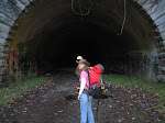
I started looking at places that our family had visited out west...different hikes that we had taken and cool geological formations that we had seen in person. I was curious as to how they would look from an aerial point of view...that kind of thing. Then I started thinking about places that I had enjoyed as a child, places that I had not necessarily seen in many years, and I wondered what they might look like today. And thus began the journey...some were difficult to remember, and others came right back to me.
I, of course, totally forgot about any classroom application for this tool. I started thinking about mapping out fun stuff from when I was a kid for my own children to see. I could upload pictures to go along with my memories...there are all kinds of possibilities. It is an awesome and powerful program. Information accessibility today is staggering.
Well...I guess I know what I will be doing all weekend!
No comments:
Post a Comment